
Sources Around Fishers Neighbors
The most reliable block lookup starts with geography. Fishers and Hamilton County maps identify parcels, addresses, streets, subdivisions, and nearby boundaries. The county property roll then supplies deeded-owner and mailing fields for one parcel at a time. Voter data has strict search and disclosure rules, while civic records can identify an association, grant project, board action, or public issue without naming every household.
| Source | What It Shows About a Block | Access |
|---|---|---|
| Fishers and Hamilton GIS | Parcel shapes, addresses, streets, subdivisions, ZIP and zoning context | Free map viewers; city or county office |
| Hamilton Property Reports | Deeded owner, situs, mailing address, transfer fields | Free portal; Assessor and Real Property offices |
| Indiana voter records | Individual registration, precinct and district when a person is known | Name, birth date and county lookup; regulated county request |
| Fishers neighborhood programs | HOA contact route, grants, board minutes and projects | City pages, Clerk request, phone or form |
| HEPL historical sources | Older address clues in directories, maps and newspapers | Library catalog, databases and in-person help |
A deeded owner may live elsewhere. A mailing address may belong to a management office, institution, or remote owner. Adjacent lots can also be vacant, commercial, common space, or public land. Describe the result as a parcel relationship until a dated, lawful source actually supports occupancy.
Fishers Parcels Are Not People
Map adjacency is exact in one narrow sense: two parcel polygons share a boundary on the selected layer and map date. It does not show that the owners know each other, that either owner lives there, or that every household member is named. This distinction matters across newer subdivisions, shared drives, HOA common areas, institutional tracts, and the Geist-area edge of Fishers.
Keep the property or situs address separate from the owner's mailing address and the USPS postal city. Fishers annexation does not automatically change a ZIP or mailing address. A parcel inside the city can carry a Fortville or McCordsville postal route, and that postal label does not move the parcel outside Fishers.
Useful rule. Write “parcel bordering the target parcel as of the map date” until a separate source supports a claim about neighbors.
Map Fishers Neighbors by Parcel
Fishers GIS and Hamilton County GIS cover overlapping views of the block. Search an exact address or parcel, select the target polygon, and turn on parcel, address, street, subdivision, zoning, trail, and ZIP layers as needed. The official Fishers resources describe parcel, owner, subdivision, and address searches, map identification, printing, and mailing-list tools. No one-click “neighbor” or documented buffer tool was found, so use the verified touching-polygon method.
The county viewer is valuable when a block sits near a Fishers boundary, annexed area, or postal-city edge. Carry the same county parcel identifier from one map to the other. Save the map scale, active layer names, date, and any uncertain boundary instead of treating a screen label as timeless.
Walk a Fishers Block Outward
This process keeps a Fishers neighbors search tied to one small radius. It does not reproduce the full record chain for an entire named street.
- Search the exact address in MapFishers or Hamilton County GIS and identify the target parcel polygon.
- Turn on parcel, address, street, and subdivision layers. Record each polygon that shares a boundary.
- Save each parcel ID, then open its Hamilton County Property Report for deeded owner, situs, mailing, and transfer fields.
- Compare mailing and situs fields, but do not label the owner as an occupant without independent proof.
- Record the source and retrieval date. Repeat only as far around the block as the original question requires.
For every parcel along the road, shift to the Fishers street directory, which follows address, parcel, deed, and historic records across the whole named street.
Fishers Neighborhood Contact Channels
The Fishers HOA and neighborhood program collects association contact information and provides a city contact route. It does not publish a household or member directory. Use it to identify the proper association contact or civic program, not to build a roster.
HOA Program
Community Outreach Manager
Samantha Wisecup
317-567-5116
wisecups@fishers.in.us
City Clerk
Board minutes, ordinances, appointments, grant records, and particular public-record requests.
Crossroads Center
HEPL help with historic directories, maps, newspapers, neighborhood names, and local files.
Verify the outreach contact on the live city page before use. For a dated association project, ask the Clerk for an existing minute, grant application, award, or record rather than asking the city to create a current list of Fishers neighbors.
Fishers Grants Map Civic Activity
The 2026 Neighborhood Vibrancy Grant announcement, dated November 5, 2025, described the program's 26th year and matching support up to $25,000. Grant applications, awards, committee minutes, and project sites can place public activity in a named Fishers neighborhood.
That evidence belongs to the project and date. It does not name all residents or prove association membership. The city boards and commissions page, City Clerk minutes, and grant records are the right follow-up channels. APRA can request a particular existing public record, subject to redaction, but does not require the city to compile a new neighborhood roster.
Note: A public grant can confirm neighborhood activity while leaving every private household and membership list outside the record.
Fishers Voters Are Not a Block List
Indiana Voters is an individual check that requires first name, last name, date of birth, and county. It may return registration status, precinct, polling place, districts, and sample-ballot access. There is no public Fishers street-search control. The VRG-24 county-data route is governed by county policy, a use agreement, uniform fees, and statutory exclusions.
Address Confidentiality Program participants are protected, and registration-agency identity, declinations, full Social Security numbers, and other fields are excluded. A failed match can reflect spelling, status, county choice, or protected data. It cannot prove that a person is absent from the block.
Official Fishers Records Compared
Commercial neighbor tools often blend old directory, parcel, contact, and marketing data without showing which field came from which date. Official sources are narrower, but they make the custodian and record role clearer. Neither category should be treated as a live household census.
| Source path | Strength | Key limit |
|---|---|---|
| Official GIS and parcel roll | Parcel, map, deeded owner and dated administrative fields | Ownership and adjacency do not prove occupancy |
| City civic records | Projects, minutes, grants, boards and neighborhood contact routes | No public member roster was located |
| Commercial category | May gather broad contact leads | Source dates, accuracy, cost and removal practices vary |
For corrections, contact the government custodian for an official field or the covered private service for its own index. Removing a private listing does not remove the source public record.
Fishers Safety Records Need Context
The Hamilton County jail roster is a current custody tool, not a list of Fishers neighbors and not a court outcome. Search fields include name, subject number, booking number, custody choice, booking dates, and assigned facility. Results may show photo, name, subject number, scheduled release date, and gender. Any status needs a retrieval date.
The roster interface is shown below because it demonstrates how narrow the official record is.
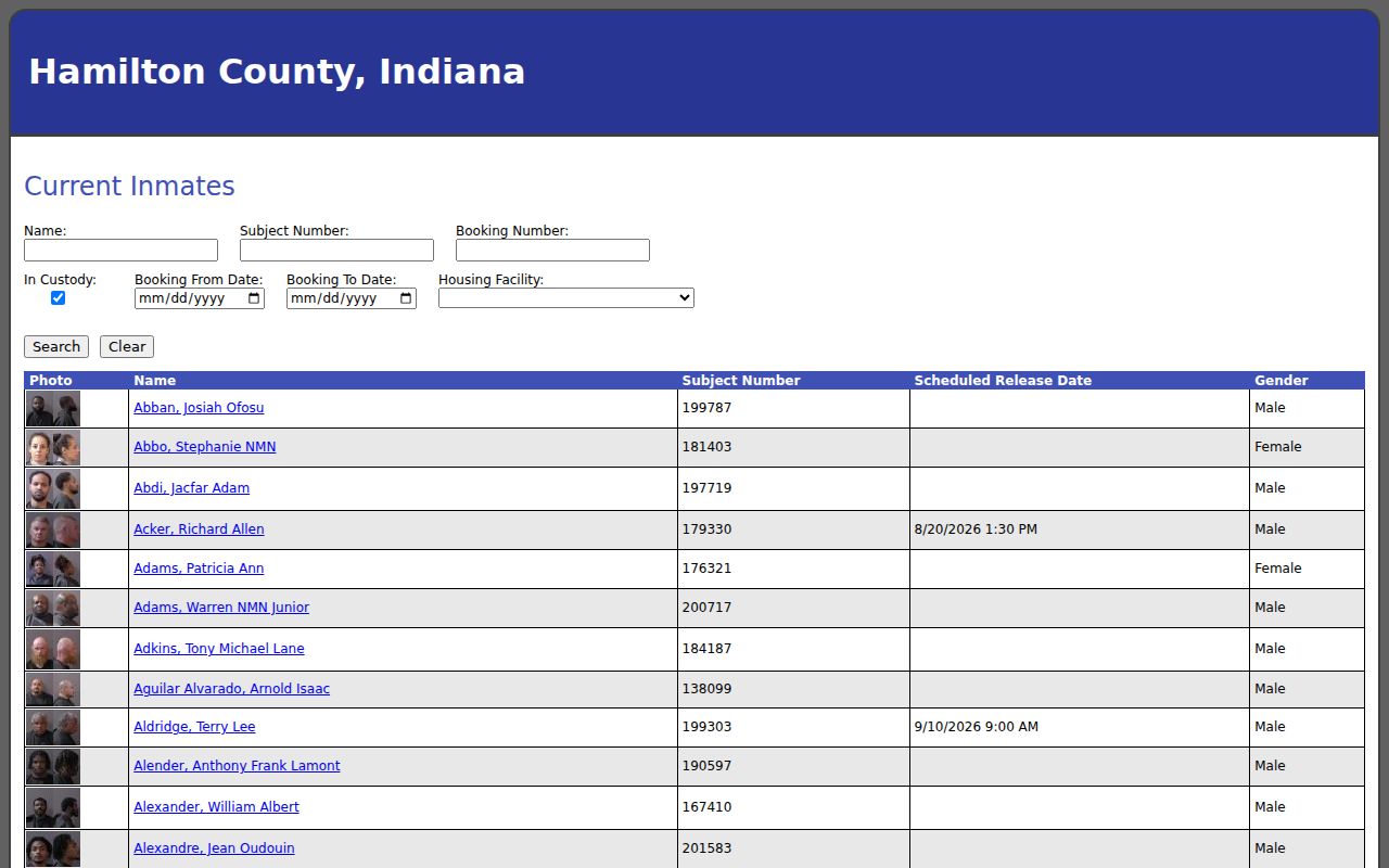
A booking does not establish residence, disposition, or guilt. Court, police, jail, and registry records must remain separate.
Fishers Property Alerts Changed
Hamilton County's Land Records Management System changed on May 1, 2025, and the county told users to re-enroll for the free Property Fraud Alert. The alert watches for a filing tied to enrolled information. It is not a title guarantee, parcel search, or way to identify Fishers neighbors.
The official county alert page documents the changed route.
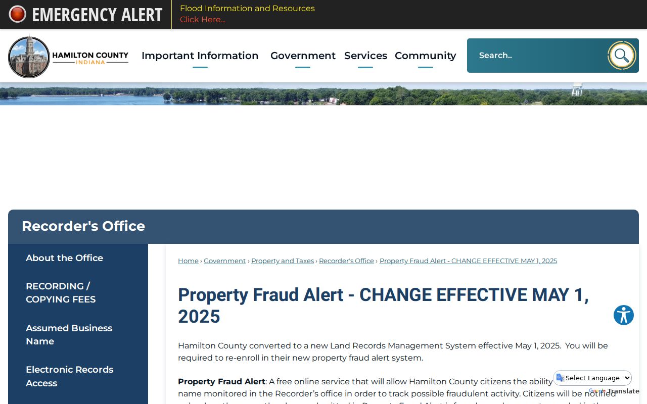
Use the county page for enrollment and questions. Keep alert monitoring separate from research about adjacent parcels or their owners.
Privacy Around Fishers Neighbors
Public sources do not provide a full household list. Renters, family members, unlisted occupants, utility customers, delivery records, and private association members may be absent. Federal driver-record law restricts DMV personal information. Indiana's Address Confidentiality Program protects qualifying victims and bars reconstruction of protected voter details.
Ask for a dated map, meeting minute, grant record, service record, or policy, not a newly made list of people. Fishers Connect and Code Enforcement can document public service issues or visible exterior observations, but neither is a resident roster. Minimize names and exact addresses when the public purpose can be met with a parcel ID, project, date, or broader area.
Lawful use. Research about Fishers neighbors may support civic curiosity and personal safety. Indiana law does not permit harassment, threats, surveillance, or attempts to expose protected residents.