
Fishers ZIP Code Coverage
Official USPS and Fishers records support four postal contexts for municipal addresses: 46037, 46038, 46040, and 46055. The first two are Fishers postal routes. City documents also show municipal Fishers places using Fortville and McCordsville routes. This is a working evidence table, not a claim that every point inside each ZIP lies in Fishers.
| ZIP | Area evidence | Postal source | Important note |
|---|---|---|---|
| 46037 | Fishers survey use | USPS Fishers FSS | Verify each address |
| 46038 | Core Fishers examples | Fishers Post Office | Post office is at 8500 E 116th Street |
| 46040 | Official park and BZA examples in Fishers | Fortville route context | Postal city can differ from municipal city |
| 46055 | East and Geist-area BZA example | McCordsville route context | Confirm parcel and city boundary |
Do not add 46056 or 46256 to a Fishers ZIP code directory without current address-level evidence. Nearby or correspondence addresses in a city document do not prove that the postal zone serves a municipal Fishers parcel.
Verify Fishers Postal Routes
The USPS Fishers Post Office listing gives the official facility at 8500 E 116th Street, Fishers, IN 46038-9998, telephone 317-913-7902. Listed retail hours are Monday through Friday 8:00 a.m. to 7:00 p.m. and Saturday 8:00 a.m. to 3:00 p.m.; check current hours before a visit. A USPS Postal Bulletin also identifies 46037 and 46038 as Fishers FSS service designations.
For a current city and ZIP pairing, use the monthly USPS City State Product or an address-verification route. Save the product or lookup date. Postal assignments change on a different schedule from municipal annexations and county parcel layers.
Fishers ZIP and City Limits
Fishers annexation guidance states that annexation does not automatically change a postal ZIP or mailing address. USPS manages postal addresses. A place may therefore be legally inside Fishers while the mail label follows Fortville or McCordsville, and a Fishers postal route does not by itself prove that a parcel sits inside city limits.
Keep four fields separate. Record the property or situs address, tax mailing address, postal city and ZIP, and municipal jurisdiction as distinct facts. None of them alone proves current occupancy.
Official Fishers examples make the distinction concrete. BZA minutes use Fishers addresses at 13571 Haven Cove Lane with 46055, 14375 Brooks Edge Lane with 46040, and 140 White Oaks Drive with 46038. City park pages also use 46040 for Flat Fork Creek Park and Geist Waterfront Park. These examples support the mismatch, but each new address still needs its own check.
Search Fishers by ZIP Code
A ZIP-wide search is a narrowing tool, not a resident roster. Fishers GIS carries a ZipCode layer or attribute, while Hamilton County Property Reports accepts partial property or mailing addresses rather than a dedicated ZIP field. Indiana Voters uses name, date of birth, and county for an individual lookup, not ZIP.
- Start with the exact street address and save the parcel’s situs address, mailing address, identifiers, legal description, and report date.
- Open MapFishers or Hamilton County GIS. Compare the parcel polygon with the ZIP, address, street, and municipal layers, and note the layer date.
- Verify the current postal city and ZIP with USPS. Do not substitute the GIS label for postal authority.
- Use an official ZIP-aware system for the task, such as the Secretary of State business-address search or Indiana Unclaimed Property.
- Once the result narrows to a road, switch to the Fishers street directory for an address-level workflow.
For a historic record, preserve the locality printed at that date. Modern ZIP codes should not be projected backward into an old deed, pre-ZIP directory, census schedule, or county map.
Fishers ZIP Search Fields
Different official systems accept different geography. The Fishers ZIP code directory works best when the user chooses a source for its actual role and keeps the result date attached.
| Official system | ZIP control | What it can establish |
|---|---|---|
| Fishers GIS | ZipCode layer or attribute | Spatial and parcel context; layer dates may differ |
| Hamilton Property Reports | No dedicated landing field | Search partial property or mailing address, then inspect returned ZIP |
| Indiana Voters | No ZIP search in individual lookup | Name, birth date, and county route to a registration result |
| Indiana SOS Business Search | Street Address 1, City, Zip Code | Entity address, not personal residence |
| Indiana Unclaimed | City and ZIP | Claim lead; claimant verification is separate |
| USPS City State Product | ZIP, city, state, county, aliases | Postal reference as of the product date |
The public voter lookup cannot make a neighborhood list, and a business address cannot identify a household. Preserve each system’s role instead of merging results into one identity claim.
Recorded Documents by ZIP
A deed index can connect a legal party with an instrument and parcel, but it does not prove that the party resides there. The Fidlar Tapestry recorded-document route is one access point for Hamilton County instruments. The Recorder also offers office terminals and other access products, while historic indexes and microfilm cover older periods.
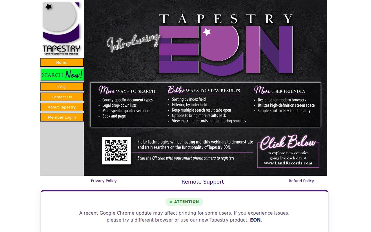
The captured portal represents the document side of the process. Start with a parcel or legal party found through an appropriate source, then preserve the instrument number, recording date, book or page, legal description, and retrieval date. ZIP is supporting geography, not the deed’s core index key.
Fishers ZIP Claim Leads
The Indiana Unclaimed Property search accepts city and ZIP information. A result is only a lead tied to the program’s records. It does not establish current residence, parcel ownership, or a full household, and a claimant must complete the state’s separate verification process.

The screenshot shows a useful ZIP-aware search that serves a different purpose from GIS or property records. Compare the name, city, ZIP, reporting organization, and source date, but do not turn a possible claim match into a present-address statement.
Know Fishers Postal Terms
Postal language can look like local-government geography even when it describes mail delivery. These distinctions prevent the most common Fishers ZIP code directory errors.
- ZIP code
- A USPS delivery-area code. It is not a municipal boundary.
- ZIP+4
- A base ZIP plus four digits that narrow delivery to a segment, building, or group of boxes.
- PO-box ZIP
- A code or delivery pattern used for post-office boxes rather than a mapped household area.
- Unique ZIP
- A code assigned to one high-volume organization; none was established here as a Fishers city zone.
- Carrier route
- A USPS delivery path within a ZIP. It may cross lines used by other agencies.
The USPS City State Product also carries aliases. An acceptable mailing alias does not settle which city, township, voting district, school area, or public-record office governs a parcel.
Fishers Growth Changed the Map
Fishers grew from 388 people in 1960 to 7,187 in 1990, 37,835 in 2000, 78,651 in 2010, and 86,459 in the 2016 special census. The city overview cites 101,171 in the 2021 census. These are dated context figures, not present resident counts.
The 2040 plan groups annexation and growth into eras from 1971 through the present. Places such as the Nickel Plate District, Saxony, Geist Waterfront, Flat Fork, Southeast Fishers, and White Oaks help orient a map, yet these labels are not interchangeable with ZIP boundaries. Rapid growth explains why a historic rural route, a current parcel, a postal city, and a municipal boundary may describe the same area in different ways.
Fishers ZIP Access Channels
Online checks include USPS, MapFishers, Hamilton GIS, Property Reports, the SOS business search, and Indiana Unclaimed Property. In-person help comes from the local post office and the Hamilton County Recorder, Real Property, GIS, and addressing offices, plus Fishers GIS, Planning, and Engineering.
For a dated public map, street-number action, parcel report, ordinance, or addressing decision, request the existing item under the Indiana Access to Public Records Act, IC 5-14-3. An office need not create a new ZIP crosswalk. Historic directories, plats, maps, newspapers, and census context remain available through HEPL, HCHS, the Indiana State Library, and NARA.
A useful request names one existing record and a date range. Ask for a particular annexation map, addressing decision, street-name ordinance, parcel report, or GIS layer as of a stated date. Include the exact street address, local or state parcel number when known, and the format sought. That level of detail helps the custodian locate the record without asking the office to research a person or build a new list.
Older address work follows another route. Crossroads and the Historical Society can compare a directory, plat, county map, newspaper, or census locality with a modern parcel. Keep the historic place label exactly as printed. Fishers Switch, Delaware Township, Fall Creek Township, a rural route, or a nearby post office can be the correct label for its time. A modern ZIP should never be inserted into a source created before ZIP codes existed.
Dates belong beside every result. Record the USPS reference date, the GIS layer date, the parcel-report date, and the retrieval date for any business or unclaimed-property result. These systems update on separate schedules. A disagreement may show timing, an alias, an annexation, or a mailing-versus-situs distinction, not an error. Resolve it through the office responsible for that field.